Spare time
RSS FeedRegion: Semilsko
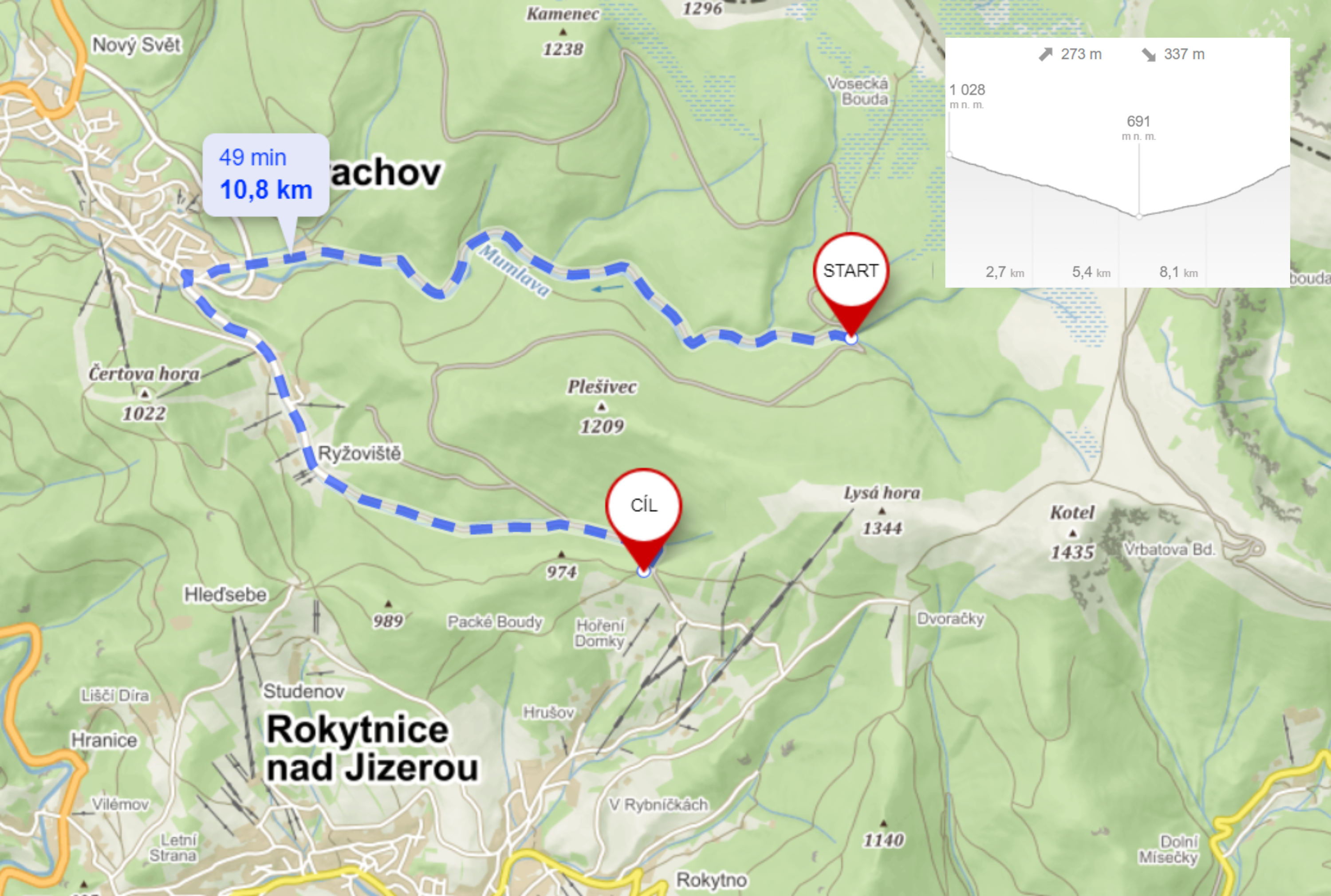
Cycle path 2B (Kladová cesta: Krakonošova Snídaně - Ručičky)
Cycling
Simply put, outside of national parks, cycling is allowed wherever it is not prohibited. Within national parks, it's the other way around - cycling is prohibited except on roads and local (not dedicated) roads.
The nature protection authority, in our case the Department of State Administration of the KRNAP Administration, can reserve certain roads and allow cycling there. In the KRNAP area, over 460 km of roads have been opened for cyclists in this way. Orientation for cyclists is facilitated by yellow KČT cycling signs. Where they are not, it is not a cycle route and cycling is legally prohibited (unless it is a road or local road).

START 1. Krakonošova Snídaně – DESTINATION 2. Ručičky
Length of route: 10,8 km - 49 minutes
Route on the map: Cycle path 2B (Kladová cesta: Krakonošova Snídaně - Ručičky)
Refreshments along the route:
Kiosek Krakonošova snídaně (Rokytnice nad Jizerou), Mumlavská Bouda (Harrachov), Srub U Lišáka (Harrachov ), Bistro Mumlava (Harrachov ), Restaurant Sport Hotel Mumlava (Harrachov ), Harrachov center, Restaurant Pod Čerťákem (Harrachov ), Ski Snack Harrachov (Ryžoviště), Restaurant Rýžoviště (Ryžoviště), Restaurant Lesní Zátiší (Harrachov – Ryžoviště), Ručičky kiosek -refreshment (Harrachov )
GPS: 50.7655625, 15.5061764
We have chosen for you